

Guwahati: Oil India Limited (OIL) has launched Airborne Gravity Gradiometry & Gravity Magnetics (AGG & GM) data for unapprised areas of Nagaland, Manipur, Mizoram, Dima Hasao, Arunachal Pradesh, Cauvery, Bastar, Satpura, Spiti-Zanskar and Karewa areas.
The acquisition of the AGG and GM survey started from Jorhat Air Base on May 27.
The Directorate General of Hydrocarbons (DGH) under the Ministry of Petroleum and Natural FGas (MoP&NG) entrusted the oil company with the responsibility of Acquisition Processing and Interpretation (API) of 40,000 flight LKM of AGG and GM data in these unapprised areas.
Factors like logistically difficult terrain, hostile environment, protected areas, and non-availability of in-principal permission for conducting seismic survey operations under National Seismic Program (NSP) were some of the problems that prevented the seismic campaign from covering these areas, an official of OIL said on Thursday.
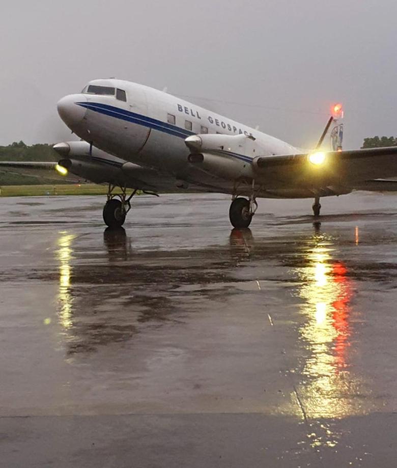
The second aircraft is scheduled to start acquisition from Dibrugarh airport to cover the northeastern part of India.
“The method is a non-intrusive exploration tool with a quick turnaround time that allows for the fastest possible covering of a large region. It also offers geoscientific value for the overall evaluation of the areas covered by the survey,” the official said.
The oil company had conducted the first-ever Airborne Gravity Gradiometry and Gravity-Magnetic (AGG & GM) survey at Dibrugarh on December 3, 2020.
The data will be acquired in seven OALP Round-I blocks, three PELs and two PMLs in the logistically inaccessible terrains of the northeast, including Dibru-Saikhowa National Park (DSNP), Brahmaputra River Bed (BRB) and geologically complex Thrust-Belt Areas in Assam and Arunachal Pradesh.
Dear Reader,
Every day, our team at EastMojo travels through rain, rough roads, and remote hills to bring you stories that matter – stories from your town, your people, your Northeast.
We do this because we believe in truthful, independent journalism. No big corporate backing, no government pressure – just honest reporting by local journalists who live and breathe the same air you do.
But to keep doing this work, we need you. Your small contribution helps us pay our reporters fairly, reach places others ignore, and keep asking the tough questions.
If you believe the Northeast deserves its own fearless voice, stand with us.
Support independent journalism. Be a Member.
Thank you,
Karma Paljor
Editor-in-Chief, eastmojo.com


“The study is expected to provide an understanding of the Sedimentary Structure & Basement Configuration, add value in understanding the ‘Regional Hydrocarbon Prospectivity’, better assess hydrocarbon prospectively in inaccessible areas and reduce ambiguity in geologically complex thrust belt areas,” the official also said.
AGG survey measures the spatial rate of change of gravitational acceleration. The sensors in the survey aircraft measure five independent components of the gravity field and provide high-resolution images of various constituents of density contrast. Magnetics is a measure of the variation in the intensity of the earth’s magnetic field caused by sub-surface geology.
Also Read | Mizoram yet to get Assam response on border-related claims